|
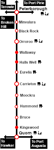
Distance from Peterborough: 95¾ kms, 59½ miles
Manned station on the Peterborough-Quorn Line up to November 1930 when all staff were withdrawn.
Passing/goods and station loops with a goods siding and loco watering facility. The original large wooden station building was demolished in 1959 and replaced by an unimpressive iron shed.
Hammond was originally planned to be the commercial centre for the region and was one of the sites selected for a proposed connection to the Wilmington Line but the population growth never reached the required level. By the time the line was closed Hammond was almost a ghost town.
The line from Eurelia to Quorn was closed in 1987 and most of the track was removed in 2008.
Today the ghost town status of Hammond has not changed. Two former railway workers cottages still survive.
|

