SAR Halls Well V2
From TrainzOnline
(Difference between revisions)
(Created page with "<!-- V2.0 --> <table> <!-- BEGIN TOP TABLE --> <tr valign="top"> <td width=750> <table width=750> <!-- BEGIN TABBED link list with Home page active--> <tr valign="top"> <td...") |
m |
||
| Line 1: | Line 1: | ||
| − | <!-- V2.0 --> | + | <!-- V2.0 (separate V1.0 file) --> |
| − | <table> <!-- BEGIN TOP TABLE --> | + | <table width=1000> <!-- BEGIN TOP TABLE --> |
<tr valign="top"> | <tr valign="top"> | ||
<td width=750> | <td width=750> | ||
| Line 33: | Line 33: | ||
</tr> | </tr> | ||
<tr valign="top"> | <tr valign="top"> | ||
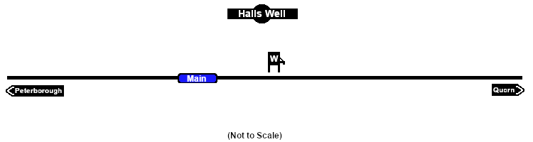
| − | <td align="center"><span style="font-weight: 700;"> | + | <td align="center"><span style="font-weight: 700;">For <span style="color: blue;">SAR Peterborough Narrow Gauge Division v2.0</span>. For the original <span style="color: blue;">V1.0</span> click <span style="background-color: yellow;">[[SAR_Halls_Well_V1|here]]</span></span></td> |
| − | < | + | </tr> |
| − | [[Image:line740.png|link=]]</td> | + | </table> |
| + | |||
| + | <table width=750> | ||
| + | <tr valign="top"> | ||
| + | <td align="center">[[Image:line740.png|link=]]</td> | ||
</tr> | </tr> | ||
</table> | </table> | ||
Revision as of 10:13, 2 May 2024
|
 |